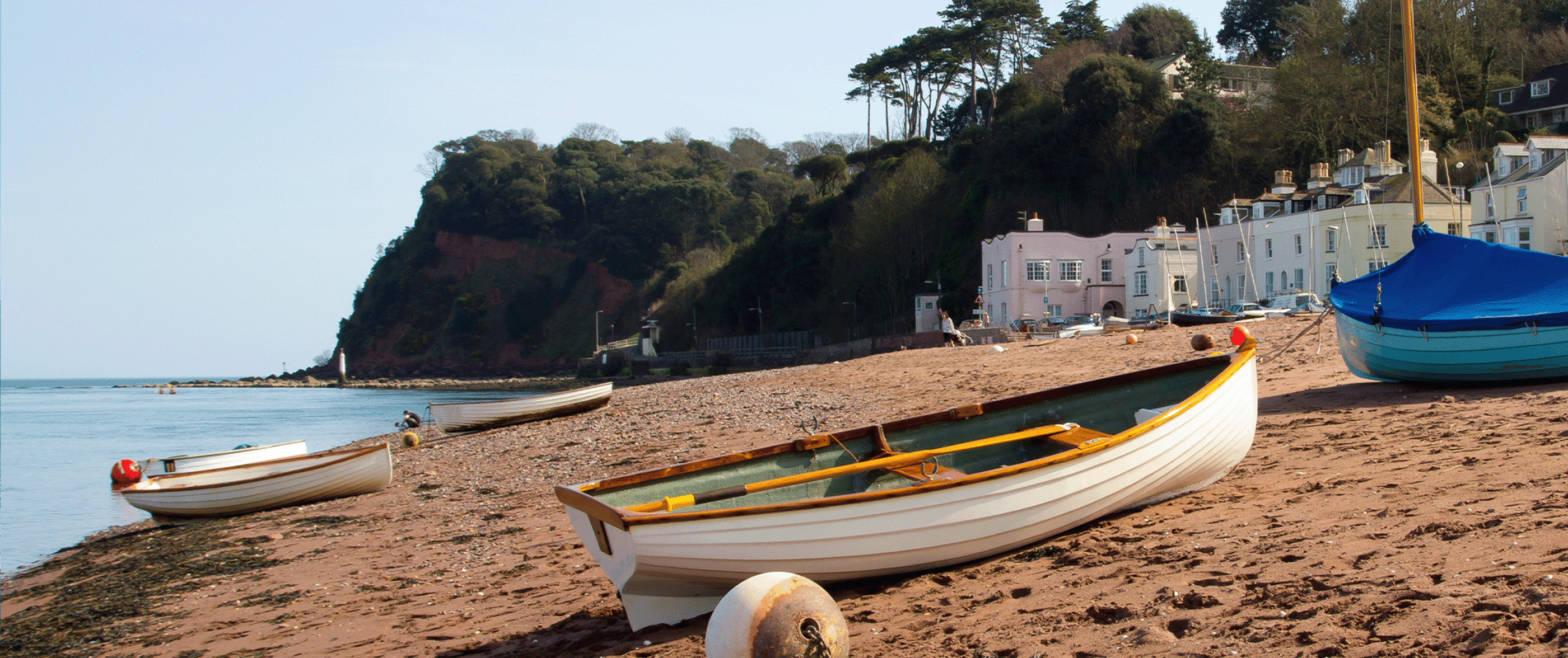
Shaldon
The delightful Shaldon Beach lies on one of the most dramatic parts of Devon’s south coast, at the mouth of the River Teign. The beach is a mixture of red sand with some areas of shingle and slopes gently into the calm, blue waters of the estuary.
The coast beyond the beach is backed by impressive sandstone cliffs from which there are great views across the river and along the coast beyond Teignmouth. Although there is no lifeguard here, Shaldon beach is a haven for watersport enthusiasts. Sailing, swimming, canoeing and rowing are all popular here.
Shaldon is also a good family beach with plenty of amenities close to hand and all the usual beach activities including shell collecting. When the tide is in, the beach makes a good spot to watch the boats coming into the harbour at Teignmouth.
Overflow locations
The map below shows the locations of the storm overflows that have the potential to impact water quality at this bathing water.
The map shows whether or not a storm overflow is currently active, the time and duration of the last spill at that location, and our investment commitments that are specific to that overflow.
Shaldon storm overflow map
Water quality sample results
The graphs below show the significant reduction in harmful bacteria in the Environment Agency’s (EA) water samples since the 1990s. E. coli and Intestinal Enterococci exist in all open water - they are found in human and animal poo, and get into the water via sewage spills, road drainage, agricultural livestock, or wildlife and birds. The EA uses the levels of these bacteria to decide whether to award this beach bathing water status.
5 year overflow spill information
The data shown in the table below is the reported annual total spill number for each overflow which has been identified by the EA for this bathing water.
The assignment of an overflow to the bathing water does not always mean an impact will occur, it can be dependent on a number of factors such as tidal state and weather conditions. Sometimes it has been allocated just for investigation purposes and has no impact at all.
All data collected goes through vigorous quality assurance processes before being included in the counts. Sometimes debris can trigger false spills to be recorded, resulting in potentially higher than actual spill numbers.
Number of spills
| 2025 | 2024 | 2023 | 2022 | 2021 | |
|---|---|---|---|---|---|
| Gales Hill Low pumping station overflow, Teignmouth | 0 | 0 | 0 | 0 | 0 |
| Milford Park pumping station overflow, Teignmouth | 1 | 2 | 1 | 6 | 2 |
| Shaldon pumping station overflow, Teignmouth | 24 | 28 | 31 | 0 | 12 |
The beach profiles were created in line with information provided by our partners, Environment Agency, RNLI, Keep Britain Tidy, MCS - Beach Guide and British Beaches.