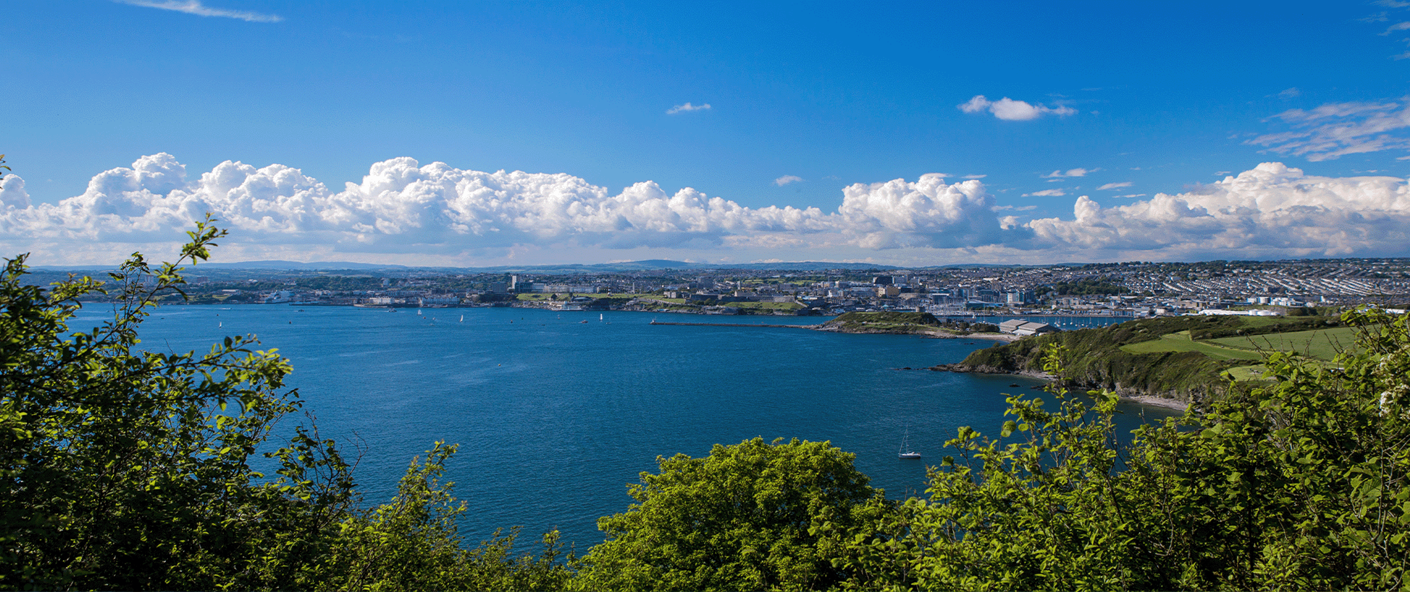
Plymouth Hoe East
Plymouth Hoe East is a developed promenade area just below Smeaton’s Lighthouse. The beach itself is rather small and composed of rocks and shingle.
This section of the coast is quite rocky and visitors wishing to enjoy an outdoor swim without the risks of entering the sea can enjoy a splash in Tinside Lido, a delightful 1930’s art-deco saltwater swimming pool.
Overflow locations
The map below shows the locations of the storm overflows that have the potential to impact water quality at this bathing water.
The map shows whether or not a storm overflow is currently active, the time and duration of the last spill at that location, and our investment commitments that are specific to that overflow.
Plymouth Hoe East storm overflow map
Water quality sample results
The graphs below show the significant reduction in harmful bacteria in the Environment Agency’s (EA) water samples since the 1990s. E. coli and Intestinal Enterococci exist in all open water - they are found in human and animal poo, and get into the water via sewage spills, road drainage, agricultural livestock, or wildlife and birds. The EA uses the levels of these bacteria to decide whether to award this beach bathing water status.
This bathing water is part of our enhanced bathing water quality monitoring trial programme.
5 year overflow spill information
The data shown in the table below is the reported annual total spill number for each overflow which has been identified by the EA for this bathing water.
The assignment of an overflow to the bathing water does not always mean an impact will occur, it can be dependent on a number of factors such as tidal state and weather conditions. Sometimes it has been allocated just for investigation purposes and has no impact at all.
All data collected goes through vigorous quality assurance processes before being included in the counts. Sometimes debris can trigger false spills to be recorded, resulting in potentially higher than actual spill numbers.
Number of spills
| 2025 | 2024 | 2023 | 2022 | 2021 | |
|---|---|---|---|---|---|
| 23 St. Peter Close storm overflow, Plymouth | 107 | 115 | 111 | 79 | 83 |
| 44 Carmarthen Road storm overflow, Plymouth | 24 | 33 | 17 | 22 | 14 |
| 5 Faringdon Road storm overflow, Plymouth | 19 | 16 | 16 | 13 | 19 |
| 59 Bretonside storm overflow, Plymouth | 51 | 70 | 63 | 58 | 64 |
| Barbican Tanks storm overflow, Plymouth | 7 | 3 | 5 | 7 | 4 |
| Billacombe pumping station overflow, Plymouth | 19 | 17 | 18 | 20 | 35 |
| Cattedown Road pumping station overflow, Plymouth | 34 | 31 | 28 | 18 | 32 |
| Shaft 16 pumping station overflow, Plymouth* | 7 | 20 | 0 | N/A | |
| Shaft 16 pumping station storm overflow, Plymouth | 127 | 141 | 102 | 120 | |
| Commercial Road/Place storm overflow, Plymouth | 4 | 0 | 0 | 0 | 0 |
| Commercial Road storm overflow, Plymouth | 24 | 8 | 0 | 1 | 0 |
| Dark Street Lane Tank storm overflow, Plympton | 29 | 30 | 28 | 30 | 26 |
| Efford Marsh storm overflow, Plymouth | 61 | 110 | 21 | 59 | 56 |
| Field outside 32 Laira Park Gdn storm overflow, Plymouth | 87 | 103 | 112 | 87 | 96 |
| Forder Valley Road storm overflow, Plymouth | 94 | 102 | 67 | 100 | 97 |
| Garrick Close storm overflow, Plymouth | 39 | 24 | 30 | 23 | 41 |
| Glenholt pumping station overflow, Plymouth | 67 | 70 | 89 | 56 | 73 |
| Harlech Close storm overflow, Plymouth | 19 | 12 | 12 | 12 | 9 |
| Honicknowle Lane storm overflow, Plymouth | 31 | 11 | 78 | 42 | 82 |
| Hooe Lake pumping station overflow, Plymstock | 6 | 2 | 3 | 2 | 5 |
| Hooe Road storm overflow, Plymouth | 18 | 19 | 21 | 14 | 22 |
| Marine Road No1 pumping station overflow, Plymstock | 8 | 19 | 12 | 10 | 3 |
| Market Road storm overflow, Plympton | 46 | 56 | 50 | 34 | 49 |
| Marsh Mills pumping station overflow, Plympton | 0 | 0 | 0 | 0 | 0 |
| Marsh Mills sewage treatment works settled storm overflow, Plympton | 84 | 98 | 86 | 46 | 74 |
| Oreston Quay pumping station overflow, Plymouth | 15 | 28 | 49 | 21 | 25 |
| Plymouth Road / Dingle Road storm overflow, Plympton | 88 | 84 | 75 | 71 | 70 |
| Plymouth Road/Embankment Road storm overflow, Plymouth | 3 | 1 | 2 | 0 | 4 |
| Radford sewage treatment works storm overflow, Plymouth | 33 | 47 | 49 | 61 | 71 |
| Radford sewage treatment works settled storm overflow, Plymouth | 21 | 6 | 6 | 5 | 14 |
| Outside 31A Pike Road storm overflow, Plymouth | 87 | 83 | 91 | 94 | 102 |
| Riverside pumping station overflow, Plymouth | 6 | 10 | 11 | 0 | 2 |
| 1 Edna Terrace storm overflow, Plymouth | 14 | 14 | 11 | 10 | 16 |
| Seymour Avenue/Beaumont Road storm overflow, Plymouth | 28 | 16 | 22 | 18 | 11 |
| Seymour Avenue/Salisbury Road storm overflow, Plymouth | 24 | 16 | 18 | 16 | 23 |
| Shirley Gardens storm overflow, Plymouth | 4 | 0 | 0 | 1 | 1 |
| Trefusis Park storm overflow, Plymouth | 42 | 51 | 52 | 42 | 64 |
| Turnchapel Barracks pumping station overflow, Plymouth | 25 | 37 | 46 | 42 | 28 |
| Turnchapel Slipway pumping station overflow, Plymouth | 30 | 42 | 29 | 33 | 26 |
*Discharges from this overflow are subject to UV disinfection.
More about what we're doing
Water-based events

The beach profiles were created in line with information provided by our partners, Environment Agency, RNLI, Keep Britain Tidy, MCS - Beach Guide and British Beaches.