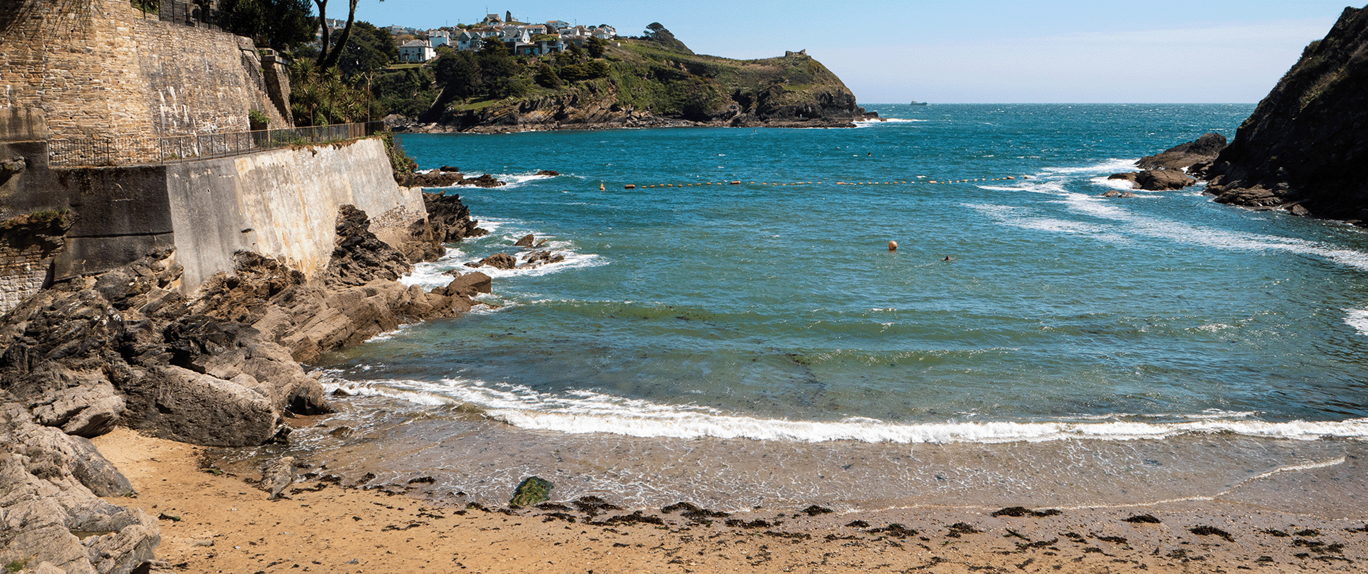
Readymoney Cove
A small, sheltered, sandy beach, slightly shelving. It is sheltered by cliffs close to the mouth of the River Fowey Estuary and bounded, on one side, by the medieval part of the Fowey and, on the other, by St Catherine's Castle. The beach can be covered during spring tides.
There is reasonably safe bathing within the cove, but not in the Fowey Estuary. However, the water can be affected after storms and heavy rain.
The beach is cleaned daily during high season and litter bins are available. There are tidal rock pools.
Overflow locations
The map below shows the locations of the storm overflows that have the potential to impact water quality at this bathing water.
The map shows whether or not a storm overflow is currently active, the time and duration of the last spill at that location, and our investment commitments that are specific to that overflow.
Readymoney Cove storm overflow map
Water quality sample results
The graphs below show the significant reduction in harmful bacteria in the Environment Agency’s (EA) water samples since the 1990s. E. coli and Intestinal Enterococci exist in all open water - they are found in human and animal poo, and get into the water via sewage spills, road drainage, agricultural livestock, or wildlife and birds. The EA uses the levels of these bacteria to decide whether to award this beach bathing water status.
5 year overflow spill information
The data shown in the table below is the reported annual total spill number for each overflow which has been identified by the EA for this bathing water.
The assignment of an overflow to the bathing water does not always mean an impact will occur, it can be dependent on a number of factors such as tidal state and weather conditions. Sometimes it has been allocated just for investigation purposes and has no impact at all.
All data collected goes through vigorous quality assurance processes before being included in the counts. Sometimes debris can trigger false spills to be recorded, resulting in potentially higher than actual spill numbers.
Number of spills
| 2025 | 2024 | 2023 | 2022 | 2021 | |
|---|---|---|---|---|---|
| Polruan Quay pumping station overflow, Polruan | 0 | 5 | 9 | 0 | 0 |
| Ready Money Cove pumping station overflow, Fowey | 2 | 0 | 1 | 0 | 2 |
| Readymoney Road storm overflow, Fowey | 0 | 7 | 14 | 5 | 10 |
| Whitehouse Slip Point storm overflow, Fowey | 7 | 2 | 7 | 2 | 0 |
| Caffa Mill pumping station overflow, Fowey | 38 | 62 | 60 | 70 | 138 |
| Fowey sewage treatment works settled storm overflow* | 72 | 91 | 100 | 80 | 173 |
| Town Quay pumping station overflow, Fowey | 198 | 264 | 125 | 199 | 156 |
*Discharges from this overflow are subject to UV disinfection.
Why does the number of assets mapped above not match the number in the spill information table?
The monitoring systems here, commonly known as Event Duration Monitors or EDMs, are in a low-lying coastal area. Normally, this equipment uses sensors to detect flows and are designed to alert us if something were leaving the network - ie there was a discharge happening. In these particular geographical locations however, we receive what we call a ‘false positive’. This means we get a notification that there has been activity, but this may have been triggered by high tide, seawater entering the network, ie. flows passing the sensor but in the opposite direction, rather than a confirmed storm overflow discharge.
As the monitor’s sensors can’t distinguish between the direction of the flow, we are not currently showing those assets on the map. Rest assured we are working hard to resolve this issue to be able to share more accurate and timely information at this site.

The beach profiles were created in line with information provided by our partners, Environment Agency, RNLI, Keep Britain Tidy, MCS - Beach Guide and British Beaches.